Planning a Boating Trip in Ontario
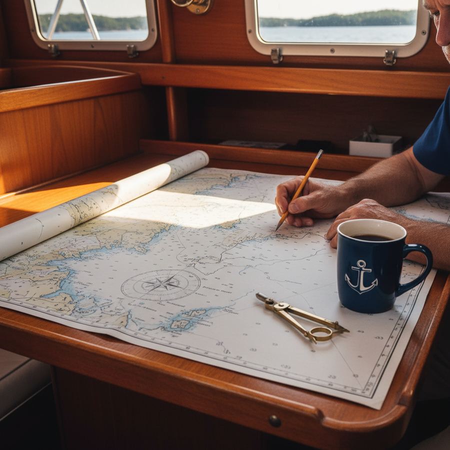
Planning a cruising trip on Ontario's Great Lakes waterways is different from booking a resort. There is no concierge. Weather doesn't care about your schedule. And the distance between fuel stops can be longer than you expect. Good planning makes the difference between a trip you talk about for years and one you'd rather forget.
Here's what to think through before you leave the dock.
The Season: June Through September
The realistic boating season in Ontario runs from mid-June through mid-September. Some marinas open in late May and close in early October, but the comfortable cruising window is narrower than that.
June is long days and empty harbours. Water temperatures are still cold, and in northern areas the blackflies can be brutal until mid-month. But the light lasts until 9:30 PM and you'll have anchorages to yourself.
July and August are prime season. Water warms up, weather is generally more stable (though thunderstorms are common in the afternoon), and all services are fully operational. This is also when marinas are busiest. If you want a slip at popular stops like Killarney or Tobermory on a weekend, reserve ahead.
September is underrated. The crowds thin out dramatically after Labour Day. Water temperature peaks in late August and stays swimmable into mid-September. Fall colour begins on the islands by the third week. Nights are cool, often down to 8 or 10 degrees Celsius, so bring layers. Some smaller marinas start reducing services after Labour Day, so confirm hours before depending on them.
Weather Patterns to Know
Great Lakes weather is driven by systems moving west to east across the continent. The key patterns for trip planning:
Prevailing westerlies. Summer winds are predominantly from the west and southwest, typically 10 to 15 knots. This favours eastbound passages and means westbound legs often involve beating into wind and waves.
Afternoon thermals. On calm days, thermal winds develop in the afternoon as the land heats up. These can add 10 to 15 knots on top of whatever the gradient wind is doing. Plan your longer passages for morning when conditions are usually calmer.
Thunderstorms. July and August bring afternoon and evening thunderstorms, sometimes severe. Watch for building cumulus in the west by midday. If you see towering cells, get to shelter. These storms can produce 40-knot gusts with little warning. Check Environment Canada marine forecasts every morning.
Fog. Common in certain areas, particularly around the Bruce Peninsula and when warm air moves over cold water. Radar is helpful. A proper foghorn is required by law.
Choosing Your Cruising Area
Ontario offers three main cruising regions, each with a distinct character.
Georgian Bay (Eastern Shore and 30,000 Islands)
The iconic Great Lakes cruising ground. Thousands of islands, pink granite, windswept pines, clear water. Navigation is demanding because of extensive shoals and rocks, many unmarked. This area rewards careful chartwork and conservative speed. Most charter operations are based here. The stretch from Penetanguishene north through the 30,000 Islands is classic territory for a one-week trip.
The North Channel
North of Manitoulin Island, the North Channel runs from Killarney to the St. Marys River. It's wilder and more remote than southern Georgian Bay. Anchorages are spectacular, with deep bays surrounded by the La Cloche Mountains. Services are sparse. Killarney and Little Current are the main provisioning stops, with very little in between. A North Channel cruise is best suited to experienced, self-sufficient crews.
Lake Huron (Eastern Shore)
The Lake Huron coast from Sarnia north to Tobermory is more exposed than Georgian Bay, with fewer protected anchorages. The harbour towns along this shore, including Kincardine, Goderich, and Southampton, are the main stops. This coast suits powerboaters and sailors who prefer town-hopping over wilderness anchoring. Passages between harbours are open-water crossings that demand weather awareness.
Distance Planning
A common mistake is planning too many miles per day. On the Great Lakes, 25 to 35 nautical miles is a reasonable daily target under sail, assuming moderate conditions. Under power, 30 to 45 miles is comfortable without burning excessive fuel.
Build slack into your schedule. You will lose at least one day to weather on a typical week-long trip, sometimes two. If your itinerary only works if everything goes perfectly, it won't work. Plan for five sailing days out of seven and you'll have a much better time.
Also account for the pace of navigation in island-studded waters. In the 30,000 Islands, you might cover only 4 knots over ground because you're threading between rocks and checking your position constantly. Open-water passages go faster but are weather-dependent.
Fuel Stops
Fuel availability is not uniform. In the southern Georgian Bay area and along the Lake Huron coast, marinas with fuel are spaced every 20 to 40 nautical miles. In the North Channel and northern Georgian Bay, gaps widen to 50 or 60 miles.
Know your boat's fuel consumption and tank capacity before departure. A typical 36-foot sailboat with a 40-horsepower diesel burns roughly 2 to 3 litres per hour at cruising RPM. With a 150-litre tank, that gives you roughly 50 to 75 hours of motoring range, which is generous. But don't assume. Some charter boats have smaller tanks, and if you're motoring in calm conditions for several days straight, the fuel goes faster than you think.
Carry a jerry can as backup if your itinerary includes any remote stretches. Better to have it and not need it.
Marina Reservations
Reservations are not always required, but they're increasingly common at popular stops during July and August weekends. Killarney, Tobermory, Little Current, and Penetanguishene fill up on summer weekends. Midweek is usually fine without a reservation.
Most marinas can be reached by VHF radio (typically channel 68) as you approach. Call ahead a few hours out to confirm slip availability. Some marinas now use online booking systems.
If a marina is full, ask about anchoring in the harbour or nearby. Many harbours have designated anchorage areas. Read up on harbour etiquette before your first marina stop if you're new to this.
Provisioning
Provision for your entire trip before departure if you're heading into remote areas. Penetanguishene, Midland, Parry Sound, and Little Current all have grocery stores within reach of the marina. Once you're in the islands, options shrink to the occasional general store with limited selection and higher prices. Buy fresh produce, meat, and dairy at the start.
Top up water tanks at every marina stop. In remote anchorages, conserve carefully. Ice is available at most marinas but not at anchorages, so a good cooler and a replenishment plan matter more than you'd expect.
Pack in soft bags, not hard suitcases. There's no room for rigid luggage on a boat. Bring layers (temperatures swing 15 degrees in a day), non-marking deck shoes, sunscreen, paper charts as backup to electronics, binoculars, and a headlamp for moving around the boat at night.
A well-planned trip on Ontario waters is one of the best boating experiences in the country. Respect the distances, the weather, and the remoteness. Plan conservatively, provision generously, and leave room for the unexpected. For more on what chartering on these waters actually involves, start there if you haven't already.